

GEOMETRICS
Benefits to using seismic methods include the low cost of a survey and the speed at which a survey can be performed. In a traditional geotechnical investigation, soil borings can significantly raise the cost of an exploration project and could damage sensitive structures like an earthen dam or levee. Add to that any logistical or site accessibility issues and the cost of the survey increases signicicantly. Passive or active seismic surveys are fast and easy to deploy and do not cause any damage to the site. A single seismic line can provide similar information to that which is obtained from drilling faster and without the risk of potential damage to the site.
Seismic evaluation has long been used to estimate the seismic hazard potential of building sites. The method is particularly beneficial when other methods cannot be performed, either due to site limitations or because the method may not be appropriate for the site. However, some engineers are hesitant to rely on geophysical data because there is a large scatter between geophysical properties and soil parameters. To address this, researchers are performing studies to determine the efficacy of geophysical surveys. In one study performed by Dr. K. Hayashi of OYO Japan and others, the researchers compared geophysical results to the results of discrete laboratory testing of soil properties.
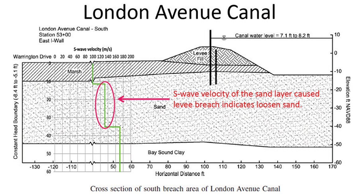
In that work, the researchers performed comparative analyses of approximately 670 km of levee bottoms and foundations along 40 rivers in Japan. The soil parameters came from about 400 boring logs carried out on the geophysical lines and included information on Fc, D20, blow counts, and soil types. Results indicate that the geotechnical soil parameters,(Fc, D20, blow counts, and soil types of levee bodies and foundations) are statistically predicted using the cross-plots of S-wave velocity and resistivity. Accuracy of this estimation was statistically evaluated and the correlation coefficients between estimated and actual parameters ranged between 0.43 and 0.8. The results imply that the geophysical properties obtained by geophysical methods, such as the S-wave velocity and the resistivity, can be used not only for qualitative interpretation but also quantitative engineering analyses …more